New Product Shows Promise for Methane Monitoring
“The potential for this technique is enormous,” — Shobha Kondragunta, STAR

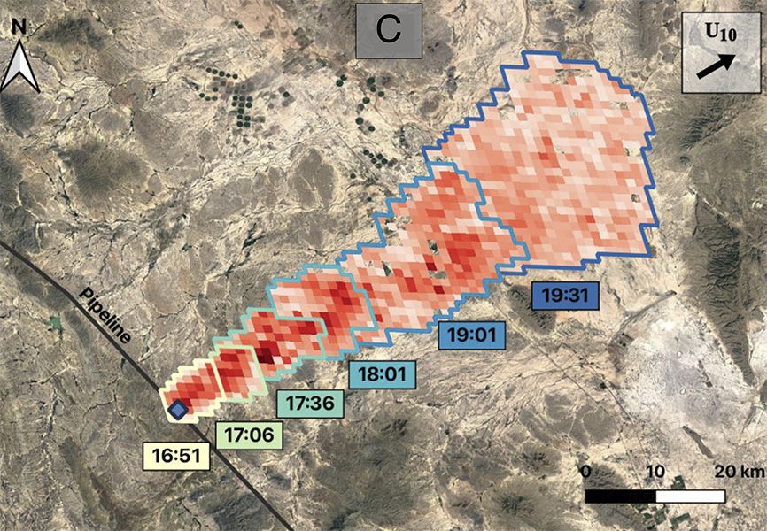
May 2019 methane plume as depicted in a new GOES data product, image credit: Daniel J. Varon - click to enlarge
February 5, 2024 -
This new geostationary data product, which has yet to be tested by NOAA,
has great potential to improve our ability
to monitor methane emissions . The technique was introduced in a recent
paper
 by Harvard scientist Daniel J. Varon and colleagues in the
Proceedings of the National Academy of the Sciences (PNAS). Methane's climate
impacts are second only to carbon dioxide in terms of warming effects.
Existing methane monitoring efforts are sourced from polar satellite data, updated once a day. The new method is based on geostationary satellite observations like the GOES constellation, which are updated every 5 or 10 minutes! The potential for geostationary satellite imagers to spot significant methane emissions “is a new development,” said Kondragunta. Working with the researchers, “we will try to bring some of those capabilities to NOAA,” she added. This increased frequency of observations is a game changer, increasing the likelihood of identifying and halting methane leaks.
