System for Analysis of Wind Collocations (SAWC)
Project Funding
This research was supported by the NOAA/NESDIS Office of Projects, Planning, and Acquisition (OPPA) Technology Maturation Program (TMP) through the Cooperative Institute for Climate and Satellites (CICS) and the Cooperative Institute for Satellite Earth System Studies (CISESS) at the University of Maryland (UMD)/Earth System Science Interdisciplinary Center (ESSIC) (grant nos. NA14NES4320003 and NA19NES4320002) and the Cooperative Institute for Meteorological Satellite Studies (CIMSS) at UW-Madison (grant no. NA20NES4320003).
Acknowledgments
The authors thank ESA, ECMWF, the NCEP/EMC Obsproc team, and Loon, LLC for providing the data; Peter Marinescu for his contributions towards converting Aeolus BUFR data into 6-hour NCEP prepBUFR for the purpose of data assimilation in NOAA NWP; Chia Moeller for her contribution towards the initial development of tools for analysis and visualization; Iliana Genkova, Jim Jung, Jaime Daniels, Cathy Thomas, and Emily Liu for their expertise on NCEP prepBUFR and winds in NOAA NWP; the Aeolus Cal/Val teams, Mike Hardesty, Erin Jones, Chris Barnet, and Sebastian Bley for their scientific and technical expertise; and Sid Boukabara for his leadership and support of this project.
The authors thank the administrators of the S4 supercomputer (Boukabara et al., 2016) at UW-Madison’s Space Science Engineering Center (SSEC) who provided the groundwork for SAWC’s initial development. The authors also thank the IT administrators at the NOAA/NESDIS/Center for Satellite Applications and Research (STAR) for their continued support in hosting and maintaining SAWC at STAR.
The scientific results and conclusions, as well as any views or opinions expressed herein, are those of the authors and do not necessarily reflect those of NOAA or the U.S. Department of Commerce.
Contact
For help regarding the SAWC wind archive or collocation software application, please contact:
STAR Webmaster

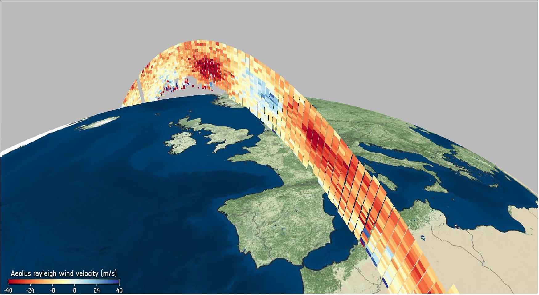
Wind profile from Aeolus 6 May 2020. Carrying breakthrough laser technology, the Aeolus satellite – an ESA Earth Explorer mission – was launched in August 2018. It is the first satellite mission to profile Earth's winds directly from space. Its data are not only being used to understand how wind, pressure, temperature and humidity are interlinked to contribute to climate research, but are also now being used in near-realtime for weather forecasting. This image is an example of Level-2B Rayleigh wind velocity in m/s second over Europe on 6 May 2020 at 06:00 UTC (image credit: ESA/VirES)
