Florida Gulf Coast Region Experiences "Historic" Rainfall Event

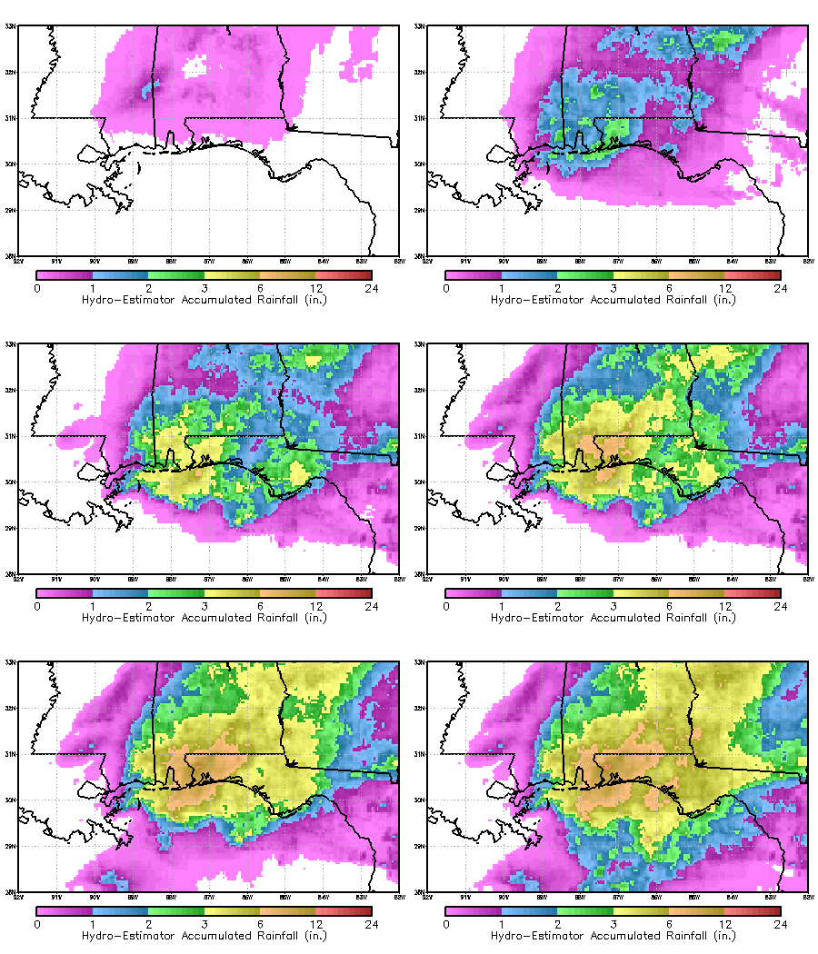
This animation loop shows satellite-estimated
accumulation of rainfall from midnight Central time on Tuesday, April
29 to 2 PM Central time Wednesday, April 30 in the Gulf Coast region.
30 April 2014 - A very strong and slow-moving springtime
storm pulled tremendous amounts of moist air from over the Gulf of
Mexico into the Eastern United States this week, producing very
intense and long-lasting rainfall that resulted in devastating floods.
The subsequent widespread flooding produced sinkholes (some very large
and deep), cut roads in half and necessitated human water rescues and
is cited as the cause for one confirmed fatality.
Pensacola's official airport rain gauge measured 5.68
inches in a single hour before it failed around 10 p.m. Tuesday night.
Official measurements for the total rainfall from this storm were
also incomplete due to failed gauges, but radar estimates by the NWS
and STAR's own hydroestimator measurements concur that the total for
the event was around 24", which is comparable to the rain output from
a hurricane, and is itself approximately a 1 in 25 year event.
5.68 inches in a single hour was characterized by the National Weather
Service as a once in 200 year to once in 500 year event.

NOAA SSD / OSDPD - Eastern U.S. Water Vapor Loop - April 29 & 30, 2014
|

